Wednesday, April 18, 2007
Onward and upward
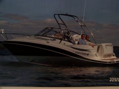
We have now traveled about 95 miles northward since our last entry. We left St. Augustine tuesday morning and traveled about 55 miles to Amelia Island, where we spent the night. The weather during the day was beautiful but, and I doubt you heard this up north, Georgia is on fire. With a wind out of the northwest, it blew the smoke onto the ICW. It almost looked like we were in heavy fog the whole day. We stayed at the Amelia Island Yacht Basin - it basically is just an inlet off the ICW. We arrived at dead low tide to the 30 ft. wide X 400 yd long entryway. Both our depth gauges agreed that it was 2'6" deep. I trimmed up the outdrive as much as I dared and we proceeded in. We slowed on two occasions and stirred up a lot of mud but finally made it into the basin. We gassed up, pumped out, and then spent the night. When the tide came in we were amazed because the range was almost 10 ft.! This is the first night that we noticed bugs - the no-see-ums have arrived. It was a nice little marina with almost noone else around afterhours. Very quiet. We woke up this morning to our canvas and boat being covered in ash from the forest fires in GA - about 15,000 acres are on fire. We detached and left the marina at about 10:00 - no early starts for us. We then traveled about 40 miles northward and stopped at Brunswick Landing Marina - WE ARE OUT OF FLORIDA. This marina is off the ICW by about 2 miles - up the East River and directly in downtown Brunswick, GA. A delightful place. The landing was easy with a nose-in tieup and the wind pushing me onto the finger pier. This marina has free wi-fi, free CATV, free LAUNDRY, and free coffee - what more could we want? We explored the town a little bit but a passing weather front forced us back to the boat to button things up. We are going to properly explore the town tomorrow. We plan on staying here until Friday morning. We then plan on heading about 65 miles north to Kilkenny Creek, GA. It is supposed to be representative of "Old Georgia", big trees, large lawns, and moss coverings. We passed Cumberland Island today but decided not to stop because we would have to anchor offshore and deal with all of that. We'll return some time by car. We will be posting pictures either later tonight or tomorrow morning. The no-see-ums continue to plague us here also. However, because the wind is out of the north, we are now north of the blowing smoke and the air is much clearer and better smelling. The last 95 miles, most of it in Florida, is unlike anywhere else we traveled so far on this trip. We are in meandering streams and rivers with an occasional creek or cut. The creeks and cuts so far have been fine in depth but we keep getting warned that will not always be the case. What is always the case is that you must not cut any corners or hug the inside of any curves if you want to keep the same prop the whole trip. We have seen and heard of several boats, mostly sailboats, who were not paying attention and left the channel. Today we had our first experience with ranges instead of markers, but it wasn't a real test because we were in a major shipping channel inlet with depths of 50 ft. - the deepest we've seen. We passed a major military area and heard over the radio that they were going to be doing a live fire drill, but not in our area. We also found ourselves in a "Homeland Security" training exercise just outside Brunswick, GA, there were 8 Contender, twin outboat boats, all marked Homeland Security and 2 large inflatables from the Coast Guard. All the boats had at least 4 persons on board. It looked to us as though they were training in high-speed boat interceptions - they were chasing each other all over the inlet at high speeds and dramatic turns. Interesting to watch - alot of fun if you were driving. Ken
Subscribe to:
Post Comments (Atom)

No comments:
Post a Comment